http://usgwarchives.net/maps/indiana/
The Indiana Digital Map Library
The state of Indiana is currently without a State Map Coordinator. If you would like to be part of the Digital Map Library team and/or make contributions, please e-mail Deb Haines. Your contributions are both needed and appreciated!
Indiana State Maps
Indiana Railroad Map 1872, (164k).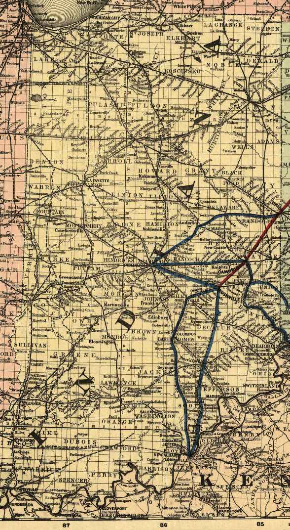
Scan courtesy of Library of Congress, American Memory website.
This is a public domain map. This large map of Indiana was converted
from a Mr Sid (.sid) formatted file. We have greatly reduced the file size by JPEG compression.
You may save on a new 3.5" floppy disk.
Mitchell Map of North America - 1851 (IN & OH)
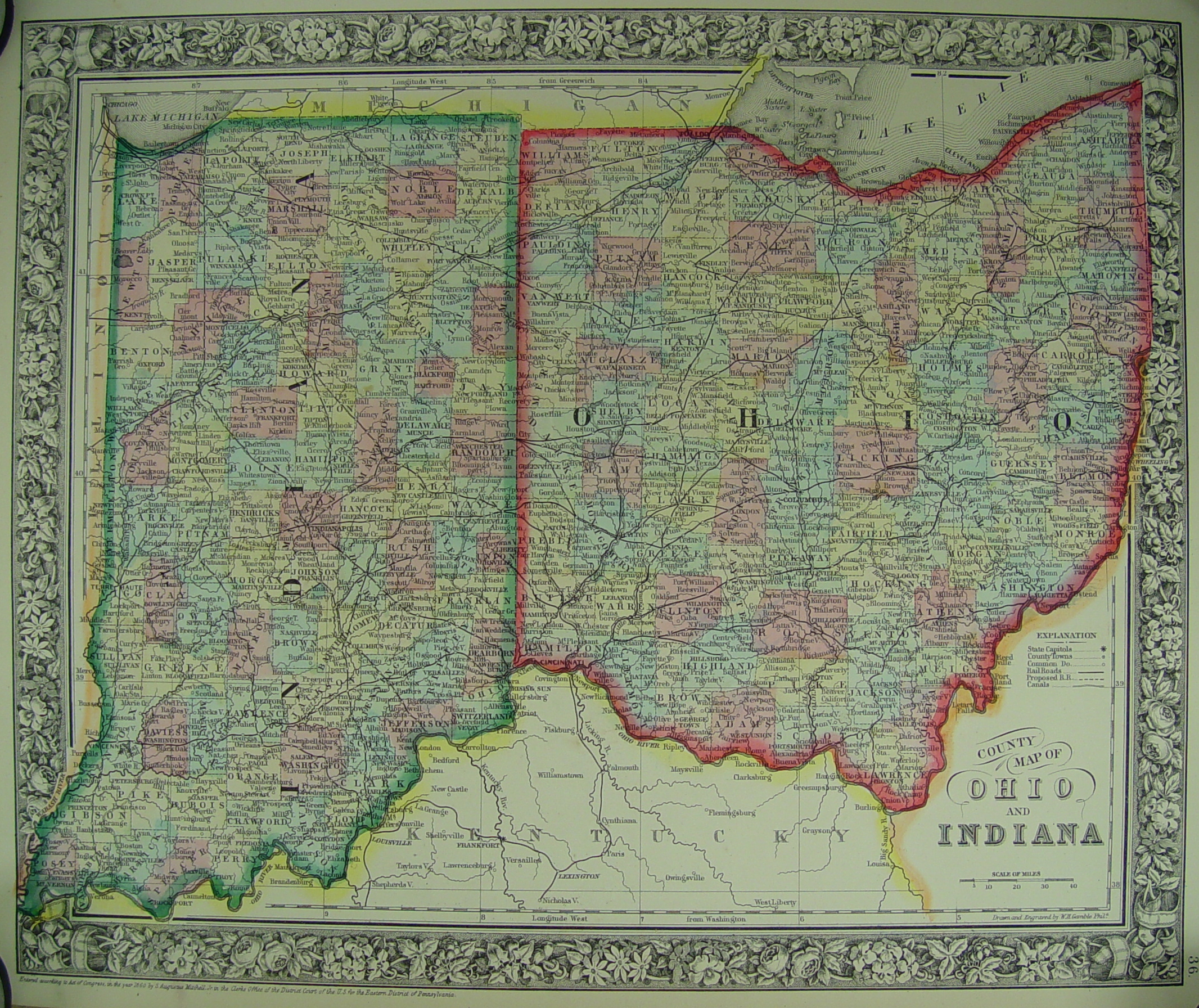
Copyright 1839, Printed 1851. Published by Thomas, Cowperthwait & Co., Philadelphia 1851.
Donated by Dean Williams
Colton Map of Indiana - 1855
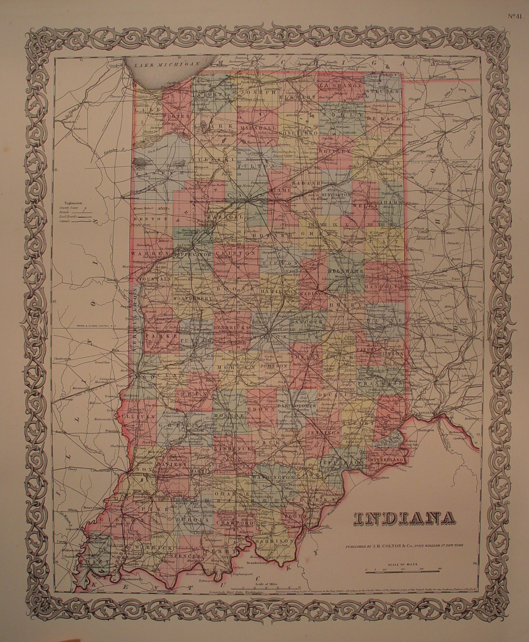
Published by J. H. Colton & Co., No. 172 William St., New York
Donated by Dean Williams
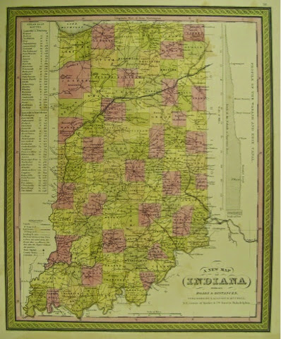
A New Map of Indiana with its Roads and Distances - 1848
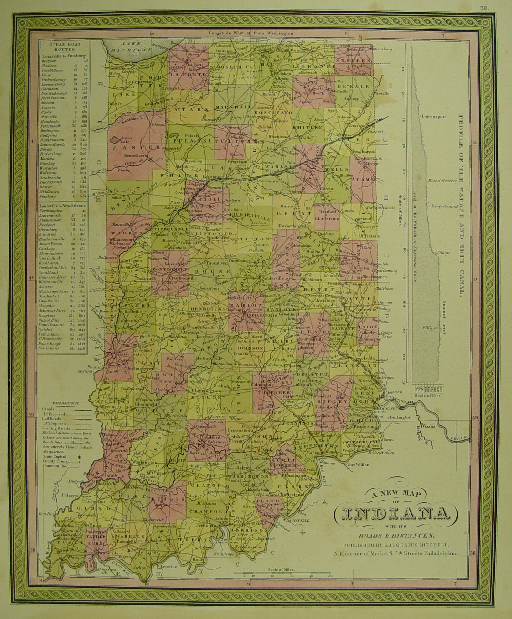
Published by S. Augustus Mitchell, NE Corner of Market & 7th St., Philadelphia
Donated by Dean Williams
Indiana County Maps


